Cape Point - Cape of Good Hope

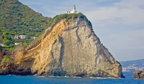
The most southwestern point of Africa is Cape Point. Known as the Cape of Good Hope or Cape of storms, this natural end on the dark continent offers incredible views of the ocean, and the opportunity to see some remnants of historic shipwrecks.
This otherwise desolate and fascinating area is located 170 kilometers in southeast of direction Cape Town. The rocks form what is known as Needle point are part of the mountain of Tafelberg.

The name comes from the Portuguese name "Agulhas" (needles) and is associated with rocks and reefs that have broken or damaged many ships over the centuries.
That is why, in 1848 a Cape of Good Hope lighthouse was built. The facility here is built on top, 238 meters high above sea level. This position is not good because the fog and clouds hide it from approaching ships about 900 hours a year.
In 1911, the Portuguese liner "Lusitania" crashed into the local rocks, with a result that meant the lighthouse had to be moved to its present location in Cape Point, at a height of only 87 meters. 6 years were needed to move the equipment from one place to another. Every 30 second, the headlamp sends off a 65 km light, which equals 10 million candles.
One of the historic shipwrecks here is that of Thomas Tucker, who crashed in the local stormy coasts. It was one of the "Liberators ships", built by the U.S. during World War II.
The Lighthouse of Cape of Good Hope is located within the National Park of Table Mountain, which is part of the world heritage sites. Surrounding areas are full of oval green hills, dotted with numerous trails that lead to deserted, wild beaches.
The sea is very rough and the waves reach 30 meters, maybe because this is the point where the Indian and Atlantic Oceans meet.
Water near the shore of Cape Point are quite shallow and are known as the best fishing area in South Africa, known as needle of Cay. The first 250 km inside, the sea depth is less than 100 meters, then the bottom drops steeply down.


